|
VALE OF WHITE HORSE VILLAGES ON THE RIVER THAMES
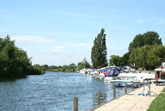
There are many attractive villages on or near the River Thames and those on the river often have riverside amenities. If they are a little way from the river it is usually only a short stroll by footpath to the river bank and this usually gives the opportunity for a pleasant riverside walk. Then what better than to enjoy a pleasant riverside lunch or drink in one of the riverside pubs or tea rooms?
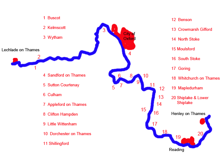
The following Thames-side villages are in the Vale of White Horse and brief information about them is given below:
Buscot (No. 1 on the map)
Wytham (No. 3 on the map)
Sutton Courtenay (No. 5 on the map)
Appleford on Thames (No. 7 on the map)
All the other villages (except Kelmscott) are in South Oxfordshire and they are described here. Kelmscott is in West Oxfordshire, and information and pictures of Kelmscott can be found here.
1 Buscot
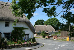
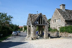 Buscot is an attractive little village which belongs to the National Trust and is a must-see if you are visiting the nearby National Trust property at Buscot Park. Stroll through the village to Buscot lock and maybe walk along the footpath to the parish church which is about a quarter of a mile from the lock. Buscot is an attractive little village which belongs to the National Trust and is a must-see if you are visiting the nearby National Trust property at Buscot Park. Stroll through the village to Buscot lock and maybe walk along the footpath to the parish church which is about a quarter of a mile from the lock.
There is a village shop and tea room, although this can be very busy on summer weekends. The tea room at Buscot Park is not far away and can be used without entering the park.
Buscot is on the A417 about 2 miles from Lechlade and is
the last village before you cross into
Gloucestershire.
Find Buscot on the Ordnance Survey map |
3 Wytham
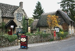 Much of Wytham
is owned by Oxford University and it is beautifully kept
with no building allowed that is not compatible with
the rest of the village. On
the other side of the A34 towards Wolvercote, and across
the bridge over the Seacourt Stream, is the site of Godstow
Nunnery on the banks of the River Thames. The nunnery
is now a ruin but once there was a magnificent church,
courts, cloisters and a chapter house. Close to Godstow Nunnery is
Godstow Lock. Much of Wytham
is owned by Oxford University and it is beautifully kept
with no building allowed that is not compatible with
the rest of the village. On
the other side of the A34 towards Wolvercote, and across
the bridge over the Seacourt Stream, is the site of Godstow
Nunnery on the banks of the River Thames. The nunnery
is now a ruin but once there was a magnificent church,
courts, cloisters and a chapter house. Close to Godstow Nunnery is
Godstow Lock.
There is a small village shop with a tea garden and a pub in the centre of the village. A little further along the road, on the other side of the Thames, is The Trout Inn in Lower Wolvercot.
Wytham
is just to the west of Oxford's
Western Bypass Road, the A34, on the banks of the Seacourt
Stream.
Find Wytham on the Ordnance Survey map |
5 Sutton Courtenay
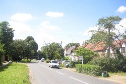 Sutton
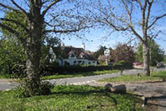
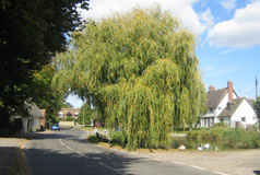
Courtenay is a largish straggling village on the south
side of the River Thames. In the centre of the village is the Manor House which, together with the house now known as
Norman Hall, is on the site of a former Royal palace. On the other side of the road is a building now known as 'The Abbey'. This was the Rectory
House and was built in the 13th century incorporating
some of an earlier dilapidated Parsonage that had been
used as a Grange for Abingdon Abbey. Sutton
Courtenay is a largish straggling village on the south
side of the River Thames. In the centre of the village is the Manor House which, together with the house now known as
Norman Hall, is on the site of a former Royal palace. On the other side of the road is a building now known as 'The Abbey'. This was the Rectory
House and was built in the 13th century incorporating
some of an earlier dilapidated Parsonage that had been
used as a Grange for Abingdon Abbey.
Although the River Thames is not visible from the road, footpaths lead to the river which actually is only yards from the road. Make use of the Ordnance Survey map option from Bing maps.
Sutton Courtenay is fortunate in still having a selection of pubs for a meal or just a drink.
Sutton
Courtenay is about 3 miles north-east of Didcot.
Find Sutton Courtenay on the Ordnance Survey map |
7 Appleford on Thames
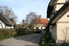
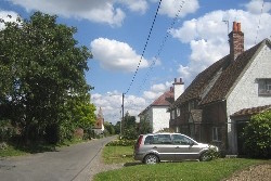 Although Appleford-on-Thames is close to the River Thames, and its name implies it is on the river, like several of the Thames-side villages the big mystery for a visitor is just where is the river? For there is no obvious sign of it! In fact the river is less than 500 metres to the north of the village centre, but there is no direct access to it from this part of the village. Although Appleford-on-Thames is close to the River Thames, and its name implies it is on the river, like several of the Thames-side villages the big mystery for a visitor is just where is the river? For there is no obvious sign of it! In fact the river is less than 500 metres to the north of the village centre, but there is no direct access to it from this part of the village.
Appleford was once a key crossing point along the river and there was once a bridge over the Thames here. As well as the present parish church of St. Peter and St. Paul it is known that there used to be a church (dedicated to Saint Mary Magdalene) at the south side of the bridge.
This area of Oxfordshire was, until the middle of the last century, part of Berkshire and historically Appleford was a place where apples from the Harwell orchards were carried across the Thames into Oxfordshire.
In the centre of the village is the start of Church Street which leads to Manor Farm and the parish church, and from the church a footpath starts which is the only public access to the River Thames. The river is about 1 km to the east along this path.
Appleford-on-Thames is north of Didcot and west of Sutton Courtenay on the B4016.
Find Appleford on the Ordnance Survey map |
|
